Is El Niño stronger than ever? Scientists watch the Pacific Ocean
According to the UN, there's an 80 percent chance of forming this summer and 90 percent until the end of the year, and it's a record temperature in the oceans because it's peaked.

Map of El Niño.

Scientists are watching the Pacific Ocean as it evolves as warming signals detected in recent weeks have raised the possibility of a strong development of the El Niño phenomenon, which could increase the risk of extreme weather events in several regions.
This phenomenon has taken on special significance because it is taking place in an unusual context: the world's oceans have a higher temperature than ever before, and the Earth is constantly warming up.
Specifically, the World Meteorological Organization has indicated that El Niño is likely to form in the coming months (in 8 out of 10 scenarios).
However, experts insist that it is not possible to know what the evolution of the phenomenon will be, and that forecasts of intensity should be taken with caution.
Signs of the Pacific
Satellites, buoys and marine sensors have detected an unusually large and warmer body ofwater in the Equatorial Pacific, hundreds of meters deep.
This accumulated heat acts as a reservoir of energy which, if it rises to the surface in the coming months and remains there, can further heat the ocean and make El Niño come stronger.
Scientists watch these signals attentively, as similar situations have been the precedent for some of the largest El Niño in decades.
How does the climate change on Earth?
El Niño is part of the natural phenomenon known as Southern Oscillation, a climate variability that alternates hot and cold stages in the equatorial Pacific and can affect climate evolution on a global scale.
Normally, the east winds push the hot water to the west of the ocean. When these winds weaken, the warm waters move eastward, which alters the circulation of the atmosphere and the distribution of precipitation and temperatures in different regions of the world.
The system does not work in isolation. The ocean and the atmosphere are in constant contact. Maialen Martija , a meteorologist at Euskalmet, explains that what happens in the ocean affects the atmosphere and what happens in the atmosphere, in the ocean. The El Niño phenomenon can also affect areas far from the Pacific by teleconexions.
South America, Australia , Southeast Asia, and some parts of Africa are generally some of the most dangerous.
Is El Niño coming super?
Some models suggest a 25% chance that temperatures in the Equatorial Pacific will rise by two degrees next winter, a threshold often used to identify particularly powerful El Niño phenomena.
However, this does not mean that the effects will be proportional or equal in all regions. The evolution of the phenomenon depends on many atmospheric and oceanic factors which have not yet been completed.
A natural phenomenon on a warmer planet
El Niño, which is part of the Earth's climate system and has been active for thousands of years, usually appears in cycles of three to seven years and is not a direct consequence of climate change.
Martija warns that attributing temperature records only to El Niño is too simple. The phenomenon operates on an already altered climate base, which can reinforce extreme situations without being the primary cause.
This additional energy also affects marine ecosystems and increases the risk of massive coral bleaching in some regions of the planet.
Global impacts amid uncertainty
Every El Niño event has its own characteristics, but years of experience make it possible to identify some recurring patterns.
The phenomenon is often associated with changesin rainfall, longer heat waves, droughts, floods, and forest fires in various regions of the world, which can directly affect agriculture, fisheries, and water resource management.
For now, the big question is not whether or not El Niño will develop, but what intensity it will gain and how it will converge with the current climate situation in a context that is one of the hottest since modern records exist.
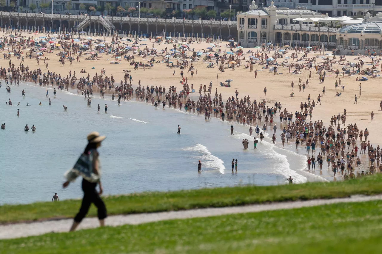
The Cantabrian and the Mediterranean are also warming up.
Observations by different oceanographic buoys reflect the same reality: the Atlantic and the Mediterranean are rapidly accumulating heat.In the Cantabrian Sea, very high surface temperatures have been recorded for this time of year. In just a few weeks, some points have gone from values close to 15 or 16 degrees to about 20 degrees, clearly above normal records.
This trend can also be seen in the western Mediterranean. In the Balearic Islands, temperatures have been measured at around 26.5 degrees; these values are summer heart attacks, higher than in the early weeks of the summer season.
What will summer look like in the Iberian Peninsula?
AEMET recalls that the impact of the El Niño phenomenon is much more pronounced in America, Australia and the tropical Pacific, while in the Iberian Peninsula weather is mainly conditioned by nearby atmospheric systems such as the Azores anti-cyclone and Atlantic traffic.
The available studies have not found a clear and stable link between the summer temperatures of El Niño and those of the Peninsula. In some cases, however, slightly wetter winters have been observed, but a recurring pattern has not been established.
In this context, Martija recalls that these influences must be understood as probabilistic trends within climate variability, and not as concrete patterns that determine daily weather.
And in the Basque Country?
In the northern part of the Iberian Peninsula, studies suggest signs that are weak and dependent on climate variability.
According to Maialen Martija, a meteorologist at Euskalmet, the El Niño events have seen slightly wetter summers in western Europe, but there is not enough evidence to draw a consistent and repetitive conclusion.
Martija emphasizes that these results should be understood as minor changes within natural climate variability: they are nuances that influence the likelihood of certain situations, not factors that radically alter daily weather or climate trends.
You might like

Temperatures will continue to rise and could reach 40 degrees over the weekend
This Thursday 35 degrees will be exceeded in some places, and on Sunday up to 40 degrees can be exceeded.

Temperatures continue to rise and a yellow warning has been activated in Navarre
Temperatures will rise between 2 and 3 degrees, with values between 30 and 35 degrees.
Wednesday the heat will return
This Monday and Tuesday they arrive with cooler temperatures, on the verge of a thermometer rise from Wednesday: they will exceed 30 degrees inland.

The heat will continue today in the Basque Country, but there could be a storm in the afternoon
The highest maximum temperatures will be in Arrasate/Mondragon and Pamplona/Iruña, up to 34 ° C. In Bilbao, Vitoria-Gasteiz, Laguardia and Baiona temperatures will also exceed 30 ° C. Donostia temperatures are expected to be slightly lower, 26 ° C.

How does a solar eclipse affect animals?
Most animals on the planet behave according to sunlight, so that an eclipse affects them greatly, but not all in the same way. Some simply observe the eclipse, others adapt their activities to a lack of light.

The last strawberries and frescoes, the prelude to the summer weekend
Although Thursday morning will still be cool and gloomy, it will be clear and until Sunday thermometers will rise a little daily. It will be a summer weekend, sunny and with maximum temperatures around 30 degrees Celsius.

Very coated and cool atmosphere, the first days of the week
At least until Thursday afternoon there will be no sunshine in our country. We will have temperatures below 20 degrees until then, and even if it is little, it will get wet, especially because of the rain that will fall in the mornings.

The weekend is full of clouds
This first weekend in June we will have a new front and cloud cover will dominate on Saturday, with temperatures rising significantly on Sunday.

The clouds, the sun coming and going, and the rain
The weather will be variable over the next few days, usually it won't get much wet, but there will be a tendency to rain for several days. The sun will also appear occasionally, and temperatures will fluctuate, depending on the day.