We'll start Easter with a winter atmosphere, and it'll start to warm from Friday
From Friday, the weather will stabilize and temperatures will rise.


The Basque meteorological agency Euskalmet has announced that Easter will begin withthe winter atmosphere , and that the northern wind will bring cold, cloud cover and precipitation, especially on the cantabrian side.
As a result of the anti-cyclone situation in the Atlantic, the sky will remain gray for much of the week, and it will rain little but steadily at certain times.
On Thursday, the first day of the holiday, we will continue with unstable weather, with skies covered and faint rain, especially in the north, and fresh temperatures not exceeding 13 degrees.
The weather will gradually change on Friday. Although it will still be cloudy and some rain in the first half of the day, especially in the north, temperatures will begin to recover and some light will open in the afternoon.
Forthe weekend, the improvement will be more evident. Moving high pressures eastward will allow warmer and drier air to enter, bringing a more stable atmosphere and a marked rise in temperatures, especially on Saturday.
In the sea, too, this tendency will be felt in the waves: in the first days there will be waves of two to three feet, and from Thursday they will gradually decrease to about a meter over the weekend.
You might like
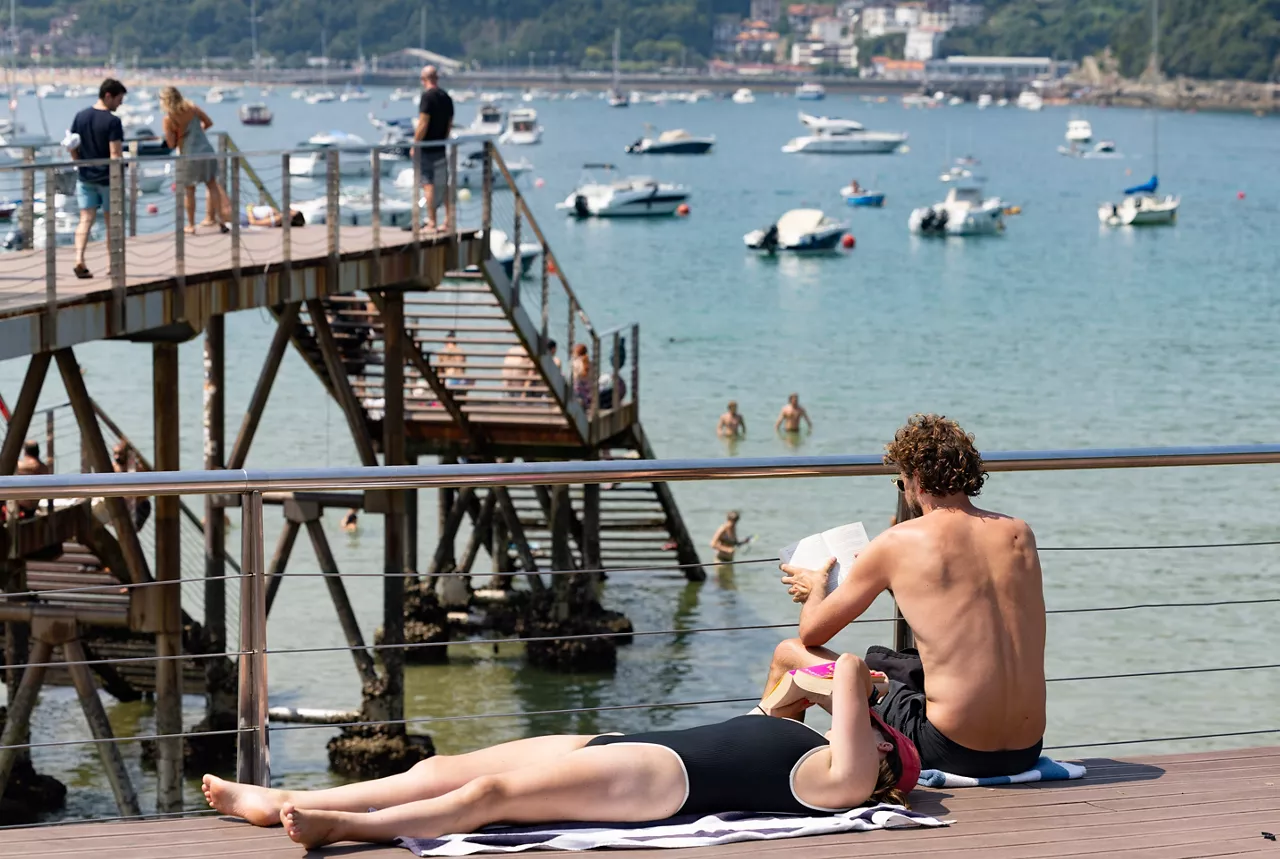
The summer atmosphere will dominate the weekend in Euskal Herria, and on Sunday temperatures will exceed 35 degrees
On Saturday the summer atmosphere will take hold and on Sunday temperatures will rise significantly, especially in the interior.

Grey and unstable start of the week in the Basque Country
Yellow warnings for heavy rainfall have been activated this Sunday, with instability at the beginning of next week, cloudy skies and occasional rain.

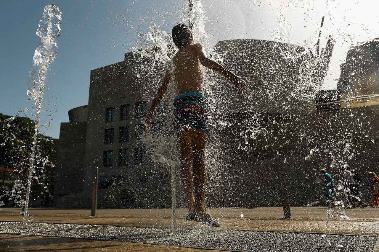
Extreme warmth in Europe
In many European countries, extreme temperatures of up to 40 degrees are still present, as warming has left extreme historical temperatures in Germany, Denmark and the Czech Republic, while authorities are using water cannons to refresh the population.
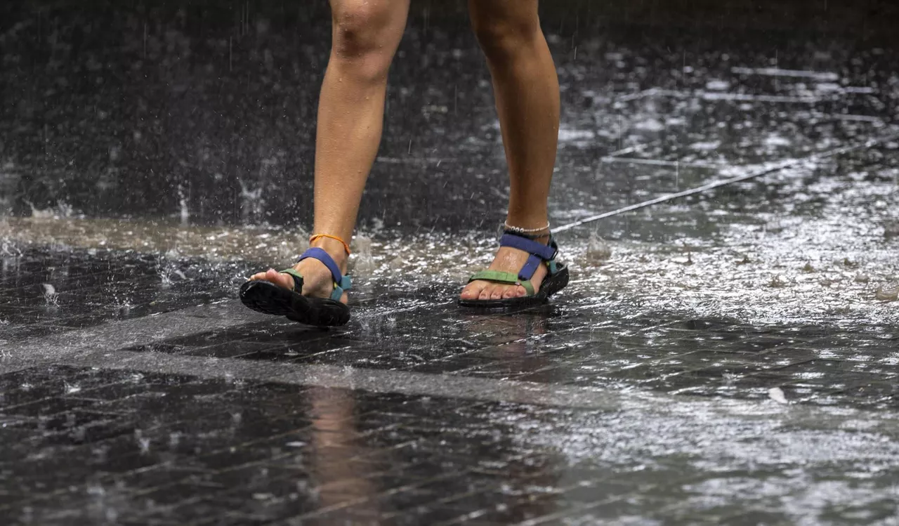
Yellow warning for heavy rains this Sunday
This Saturday the heat wave will end and the weather will take a different direction, as on Sunday it could rain more than 15 litres per square meter in an hour in the Basque Country.
The heat will rest on Sunday, and there will be a risk of storms at various points
The highs will drop significantly. on Thursday thechangewill be lowerdue to the decrease in the warmest days, as well as in the east and south of Navarre. In this sense, the warmest will be below 30 ° C in most areas.

The news will be: temperatures are starting to drop, the premiere of the documentary "Escape to Be" and the earthquake in Venezuela
In two words, a summary of what will be news of the Present today.
Red thermometers: The worst is yet to come
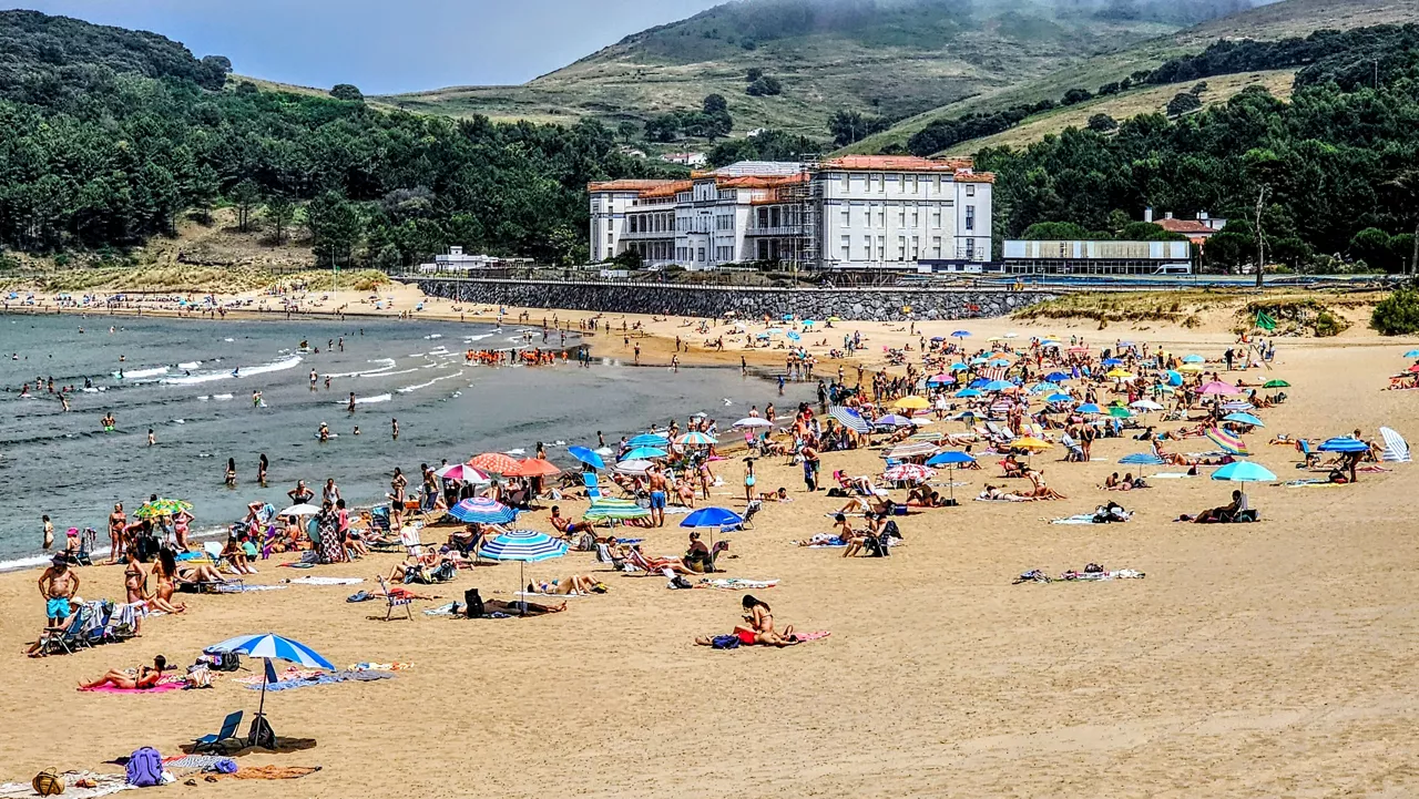
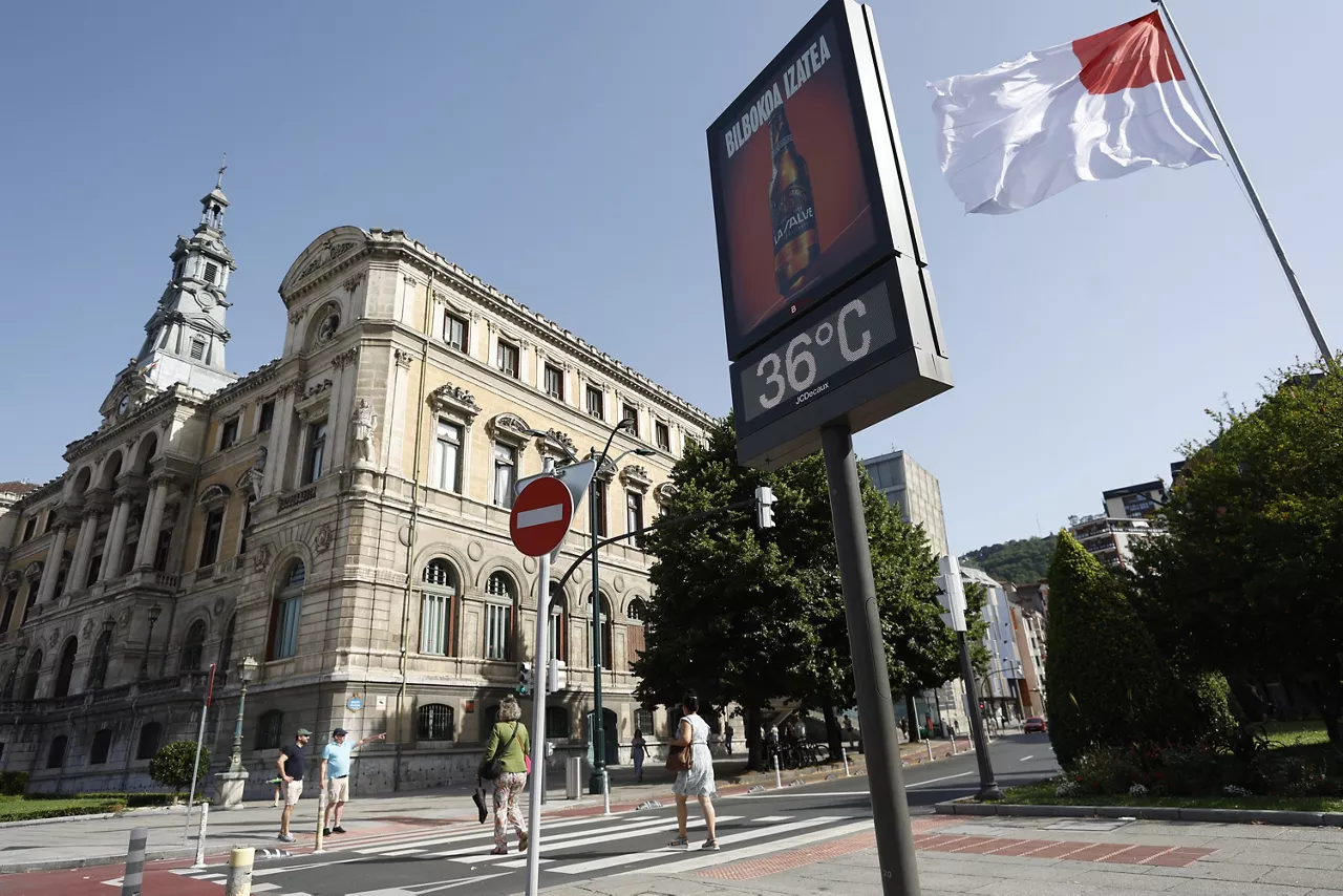
The southern wind and the strong sun have brought temperatures to a record of out-of-season temperatures.
June record temperatures at 43.6 ° C in Llodio and 42.9 ° C in Baztan
The heat will not rest, at least, until tomorrow evening. Throughout the ACV there will be a red alarm on the inside and orange on the coast. In Navarre, too, they will be on orange notice all day tomorrow.
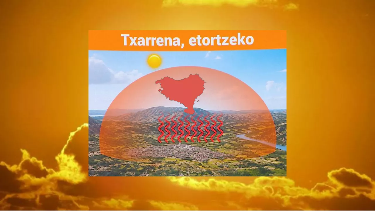
How long will extreme warming continue in the Basque Country?
Temperatures are very high in many areas, with new active alerts and highs of around 40 ° C. The situation will begin to change from the second half of the week.

Temperatures will continue to rise and could reach 40 degrees over the weekend
This Thursday 35 degrees will be exceeded in some places, and on Sunday up to 40 degrees can be exceeded.