The wind has left extreme records in the Basque Country, with speeds of 180 km/h in exposed areas
The southern wind has left streams of 180 km/h in Gorramendi, reached 160 km/h in Aralar and caused punctual problems at airports.


The strong southern wind has marked the day in the Basque Country, with very high records, both in visible areas and in populated areas, reaching 180 km/h in Gorramendi and 160 km/h in Aralar, while the coastal and inland streams have been: Zarautz (136 km/h), San Sebastian (124 km/h), Mallabia (116 km/h), Iurreta (102 km/h), Bilbao (102 km/h).
The wind has also caused some incidents at Bilbao airport. A flight from Palma de Mallorca, which was due to land at 8.25 a.m., was unable to land at Loiu and has been diverted to Barcelona, according to AENA.
The authorities have called attention to the combination of strong bursts, unstable trees, and wind-moving objects, especially in the highlands and coasts.
You might like

Cases of gender-based violence during pregnancy can be identified through health consultations
During pregnancy, women have a close relationship with the health system: they have consultations with midwife, gynaecologist and nurse. As could be the key to identifying situations of gender-based violence. Anternational experts in San Sebastian have called for a coordinated response from the health and social spheres in the summer course on Violence and Motherhood.
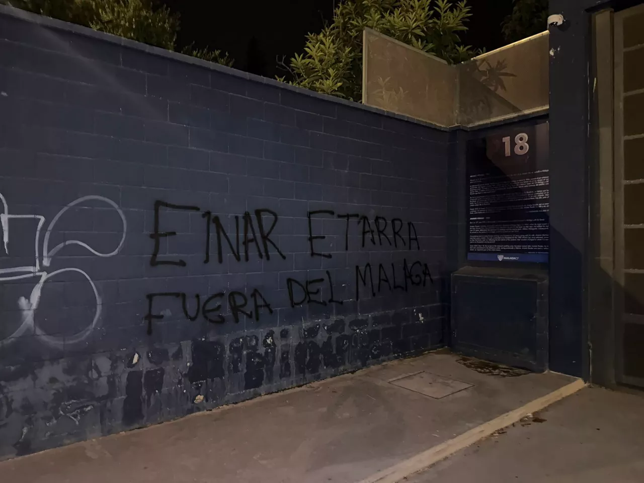
Painted against Basque footballer Einar Galilea appeared in Malaga after spreading his image with the Argentine T-shirt
Painted with insults have appeared near La Rosaleda after the World Cup final between Spain and Argentina. The photo of the Malaga player has been posted on social media, although it is not clear when it was taken.
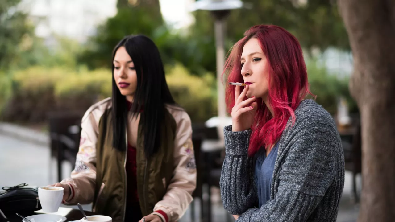
Farewell to smoking on terraces and beaches: this is the new anti-smoking law, which equates the vaporizer with the cigarette
The new law passed by the Spanish Government prohibits smoking and bathing on terraces and beaches, since it equates electronic cigarettes with traditional tobacco and provides for fines of up to 600 euros.
Two monitors have been arrested in Biarritz on charges of raping and sexually assaulting children aged three and four
The Baiona Public Prosecutor's Office has reported that, according to testimonies collected so far, evidence of 12 cases of sexual assault and one rape has been found, and no further evidence is ruled out.
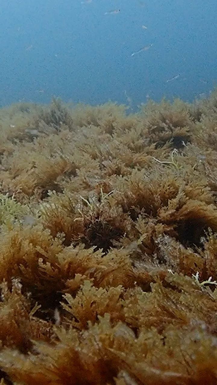
Asian algae: the green carpet that occupies the seabed of our shores
The appearance of this seaweed on our beaches is only a visible part, as Asian seaweed is forming real green carpets on the seabed of our coast, its spread threatens biodiversity and creates new challenges to control it.
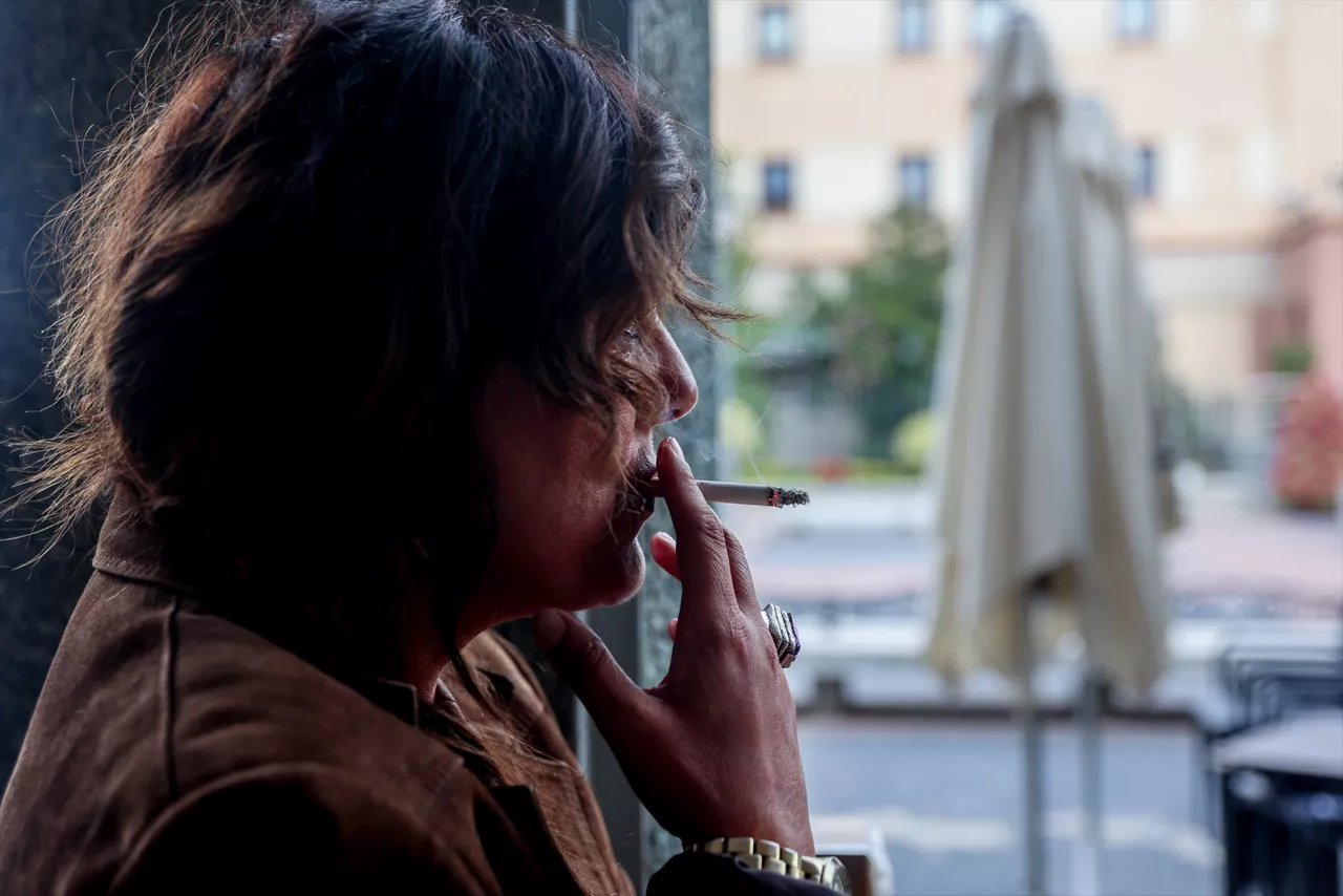
The Spanish Government has finally passed the anti-smoking law prohibiting smoking on terraces and beaches
The new regulation equates e-cigarettes and vaporizers with conventional tobacco, extends smoke-free areas and restricts the sale of new products to specialized establishments.

Euskal Encounter will bring together about 5,000 participants and more than 4,000 computers in the BEC
The technology macroconference will take place from 23 to 26 July and special attention will be paid to artificial intelligence and quantum computers.

Three women have been killed in the last 24 hours in Malaga, Alicante and Toledo by male violence
The women, aged between 30 and 59, have been assaulted by their partners, two of whom have been arrested and a third has allegedly committed suicide. Auardia Civil investigates another case in Malaga.
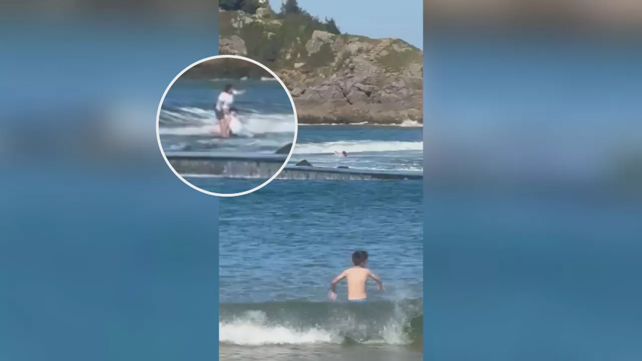
Being rescued at the pier on the island of Lekeitio could cost up to 1,500 euros
A Decree-Law 2025 provides that the cost of the rescue operation may be attributable to the rescued person if the rescue is carried out in an area marked as dangerous, as it has been for weeks in the case of the pier to the island of Lekeitio.
Withholding at the A-8 off Muskiz in the Santander sense due to an accident between two cars
As a result of the accident, a lane has been cut off from traffic and traffic jams are taking place.